Trip - Planner
Number of items:
Length of route:
There was a problem with server connection. Please, try again.
The maximum number of added points can not be greater than 20
Do you want to add {0} POIs to planner?
You did not enter a name tour
None journey points set
Zapis wycieczki zakończony powodzeniem.
Zapis wycieczki zakończony niepowodzeniem. Spróbuj ponownie.
The content of the agenda will be replaced. Do you want to continue?
Are you sure you want to delete the contents of the agenda?
Do you want to save trip?
Do you want to remove selected trips?

If You remove your account You will loose all your trips.
Are You sure You wish to remove your account?
Switching your account will remove connection with currently used social portal.
Are You sure You wish to switch your account?
Sign in with your Facebook profile
Sign in with your Google+ profile
Use this site without signing in
Saved data will be accessible only on currently used computer and browser
logo
| Start | |||
| End |

Are you sure you wish to remove current search area?


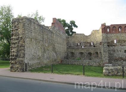
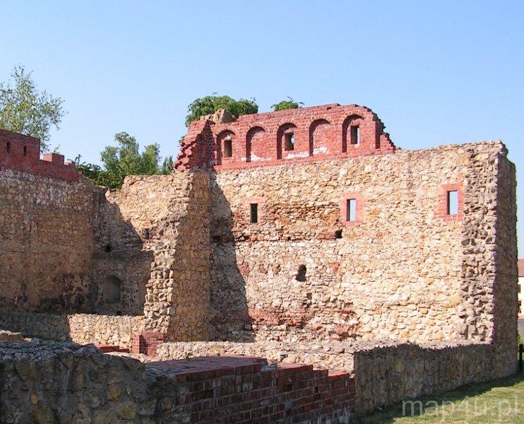
1335 r. (XIV w.)
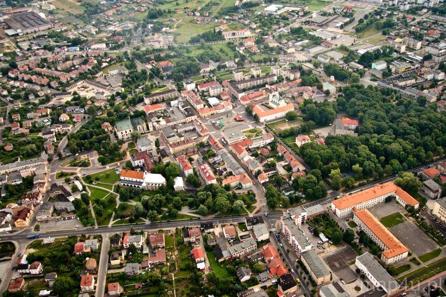
Miasto lokowano pod koniec XIII w., jednakże obecny układ ulic pochodzi z czasów po wielkiej przebudowie miasta spowodowanej pożarem w 1335 r.1335
The town was found in the end of the 13th century, however the current layout of streets is dated back to the period after the great reconstruction of the town, which had burnt in 1335.
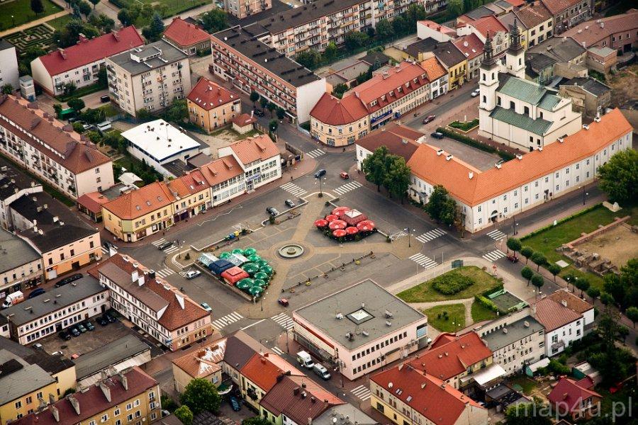
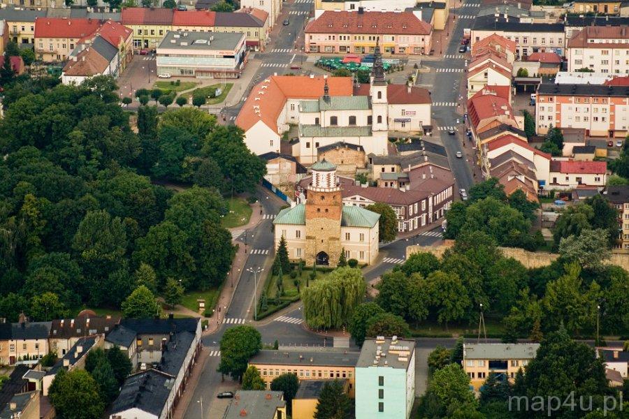
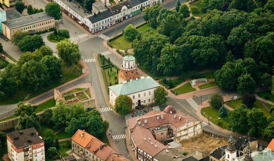
Wieluń was incorporated under German law on the order of the duke Premislaus II, who in 1283 decided that the law in all towns in the Region of Kalisz should be based on the law of his capital. One of those towns was Wieluń. It was founded on the already existing trade route running from the east to the west, which widened in that place, having the shape of a spindle. That spindle-shaped layout of a town, with chessboard pattern of streets, was a prevailing type of urban layout in Silesia. The main route was enclosed by the town gates: the Ruda (Cracow) Gate and the Dąbrowa (Kalisz) Gate, the last of which did not survive.
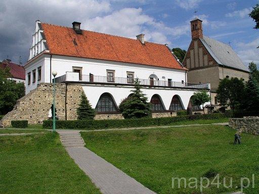
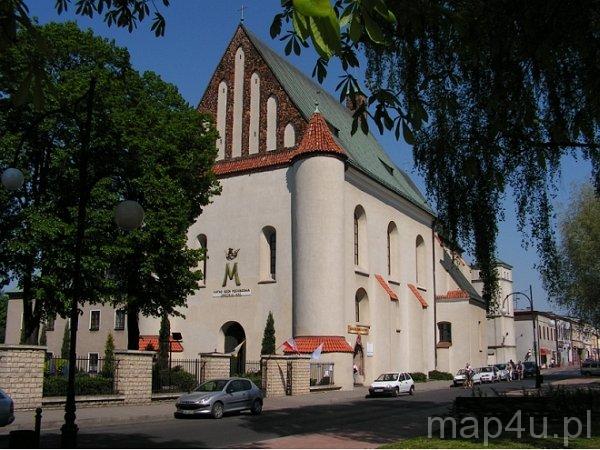
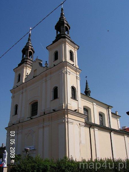
In the 16th century the New Gate (Maksymilańska Gate), called later the Wrocław Gate, was built on the south site of the city. The north gate, Reformatorska, called later the Small Gate, was erected in the 17th century. After the great fire of Wieluń in 1335 the king Casimir the Great ordered to built the walls surrounding the town, which encompassed the area of 12 ha. In addition, moats were dug around Wieluń. The market place with two parallel frontages was designed. The side streets crossed the main streets at right angles. Along them and around the market place townsmen built their houses. The monastery complex of the eremites were founded in the north-west corner of the town. The parish church and the castellan’s seat – a brick castle built on the site of a previous fortress – were located in the south-east corner of the town. At present, the neoclassical building holding the offices of the district authorities is based on the foundation of the old castle.
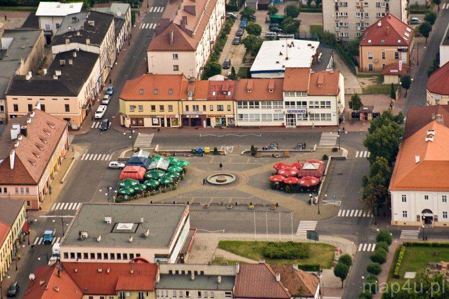
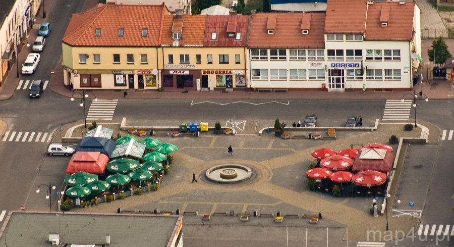
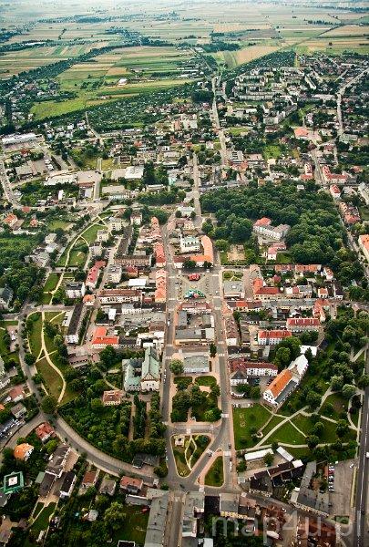
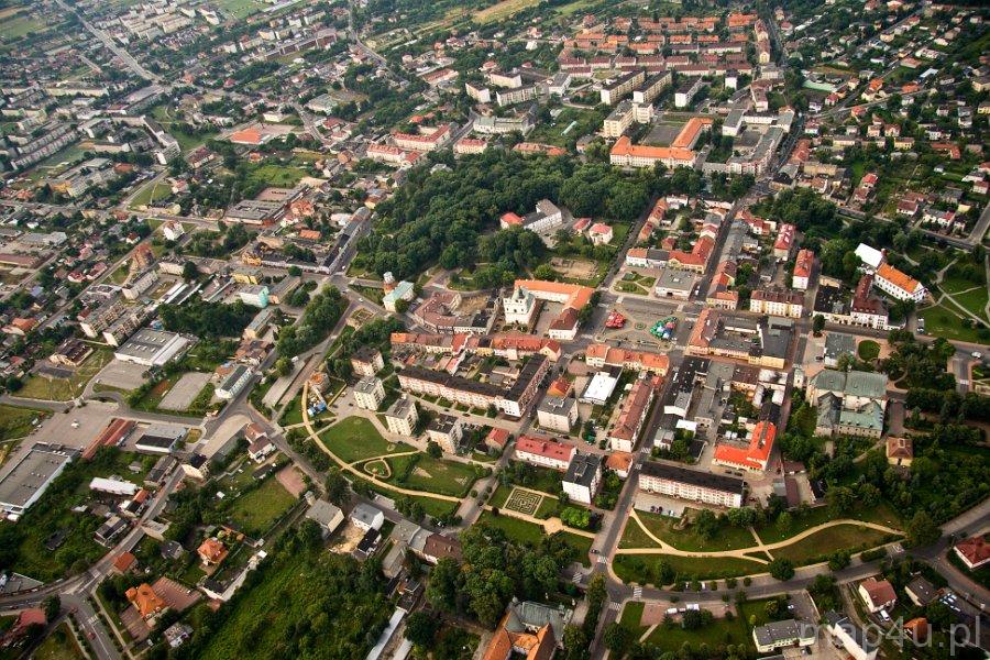
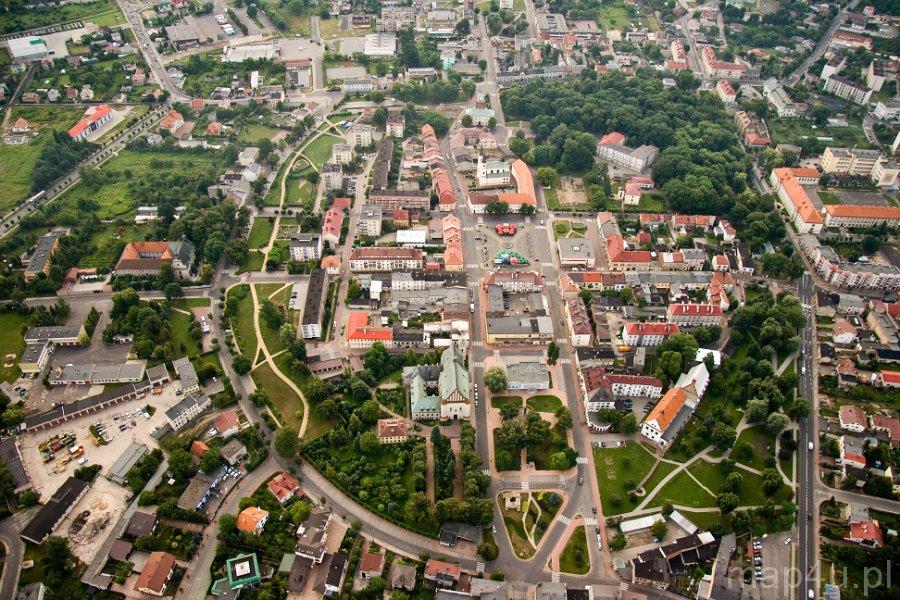
The area of the medieval Wieluń is currently enclosed within Krakowskie Przedmieście, Piłsudski’s, Zamenhoff’s and Reformacka Streets. Plac Legionów is the old market place. Wieluń is one the few towns in the Łódź Voivodeship, where the medieval layout of streets is so well-preserved, despite the fact that the town was destroyed in the second world war.
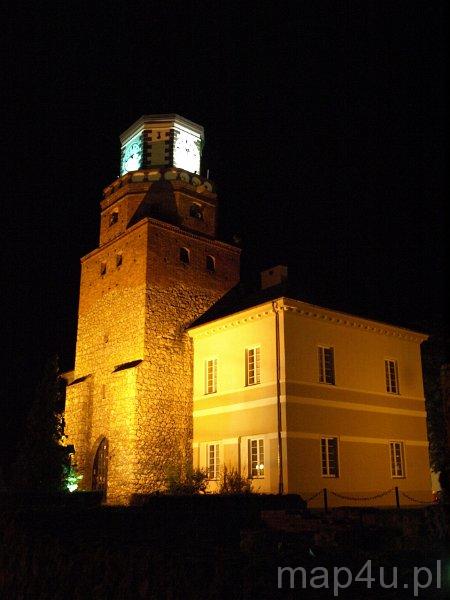
The only survived gate to the town, the Ruda Gate, called also the Cracow Gate, is depicted in the coat of arms of Wieluń. It was not demolished, because it is now a part of the town hall built in 1842. Currently, the first storey of the gate holds an art gallery.
The historic layout of Wieluń can be found in the centre of the town, enclosed by Krakowskie Przedmieście, Piłsudski’s, Zamenhoff’s and Remorfacka Streets.
Several highways cross Wieluń:
the highway 8 (E67): the country border – Kudowa-Zdrój – Wrocław – Wieluń – Warsaw – Białystok – Budzisko – the country border
the highway 45: Racibórz – Opole – Kluczbork – Wieluń – Złoczew – (Poznań/Łódź)
the highway 43: Wieluń – Częstochowa
as well as district roads:
the district road 481 linking Wieluń to Łask and Łódź
the district road 486 linking Wieluń to Działoszyn and Radomsko
There are two railway stations in Wieluń: Wieluń (also called Wieluń Miasto, on Warszawska Street) and Wieluń Dąbrowa (on Kolejowa Street 10), from where trains depart to Tarnowskie Góry, Częstochowa, Cracow, Katowice, Poznań, Szczecin and Kępno.
There is also a bus station (PKS Wieluń) on Warszawska Street 10.
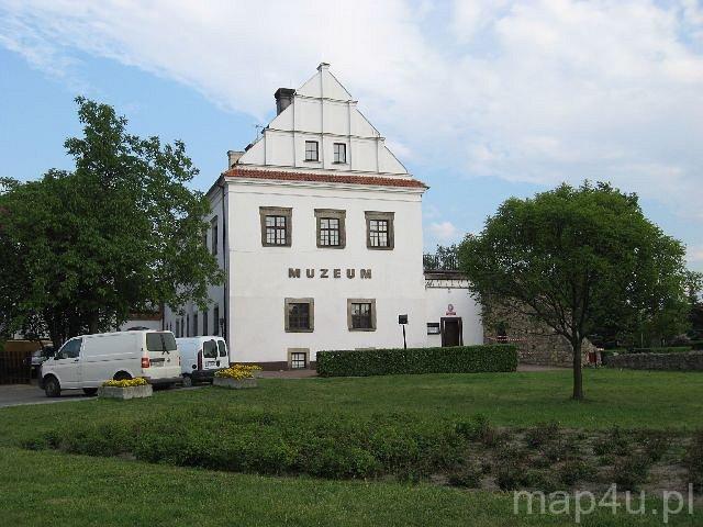
The urban layout of Wieluń is freely accessible. In the old Ruda (Cracow) Gate, there is an art deco gallery.
Telephone number: 604 856 680
e-mail: wladyslaw.luczak@wp.pl
Opening hours:
in the spring and summer season:
Tuesday-Friday: 10 a.m. – 1 p.m. and 3 p.m. – 6 p.m.
Saturday: 9 a.m. – 2 p.m.
Sunday: 2 p.m. – 6 p.m.
in the autumn and winter season:
Saturday: 9 a.m. – 2 p.m.
Sunday: 2 p.m. – 6 p.m.
1. Kulesza, M. Morfogeneza Miast na Obszarze Polski Środkowej w Okresie Przedrozbiorowym, Dawne Województwa Łęczyckie i Sieradzkie. Łódź: Wydawnictwo Uniwersytetu Łódzkiego, 2001.
2. Machlański P., J. Podolska and T. Stańczak. Spacerownik po Regionie, Czyli Szlakiem Zamków w Województwie Łódzkim. Biblioteka Gazety Wyborczej, 2008.
3. Mokras-Grabowska J. and P. Rzeńca. Województwo Łódzkie, Przewodnik Turystyczny. Łódź: Regionalna Organizacja Turystyczna Woj. Łódzkiego, 2007.
4. Olejnik, T. Wieluń. Przewodnik. Łódź: Polskie Towarzystwo Turystyczno-Krajoznawcze, Oddział w Wieluniu, Wydawnictwo Łódzkie, 1967.
5. Ruszkowski, A. Sieradz i Okolice. Przewodnik Turystyczny. Sieradz: Towarzystwo Przyjaciół Sieradza, 2000.
6. The street plan of Wieluń on the website: www.historiawielunia.uni.lodz.pl, Wojtaszek, A. And Wykusz L., based on Wilska, A. “Wieluń w Drugiej Połowie XVI w.” Atlas Historyczny Polski. Ed. S. Trawkowski, Województwo Sieradzkie i Województwo Łęczyckie w Drugiej Połowie XVI Wieku, cz. I Mapy, Plany, cz. 2 Komentarz, Indeksy. Ed. H. Rutkowski. Warszawa, 1998.
Public property.
_od_strony_zachodniej.jpg)

Click the text above you want to change to open a text editor.