logo


Information and navigation system
Description
 You are on a portal which describes all popular channels of accessing information and services concerning
tourism and culture.
The innovative system of integrated applications is available on the website for free, so they can be downloaded by every tourist who owns and uses a mobile phone or a PDA device with the GPS navigation for cars or pedestrians.
It is a serious matter, because, if experts from GSM business are to believe, smartphone (a portable phone device combing the functions of a mobile phone and a pocket computer) and its bigger brother tablet soon will have such an influence on our lives that we will not need any other devices. Smartphone is a mobile phone which has all functions, the most important of which is a touchscreen. This is its time.
This is why everybody ensures that a mobile phone should have everything which a user likes while using a traditional computer. The most important are social networks – Facebook and Twitter, as well as Google Search, Gmail or Hotmail, and entertainment – YouTube. All these functions are integrated in such a way as to enable the user to immediately have everything which he or she loves.
Investments in the new communication technology – LTE (Long Term Evolution) - allow for greater transmission capability and open new, yet unexplored possibilities for smartphone.
This portal is for tourists using interactive digital maps.
Information and Navigation System (INS).
Interactive and multilingual tourist and cultural guide
Modern forms of communication with tourists by providing information about opportunities which a tourist-friendly region offers, will be based on the technologically advanced information and navigation system, which will allow for efficient management of tourist and cultural products. In addition, the system of monitoring tourists on the move can ensure their safety and comfort on the trails.
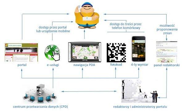
The portal, along with the whole package of integrated applications, creates the Information and Navigation System, which is, in fact, a multilingual multimedia interactive guide, which makes available:
- the catalogue of attractions and tourist facilities,
- the catalogue of transaction services in the fields of culture and tourism,
- the interactive digital map (consistent with GIS),
- the calendar of cultural and sports events,
- a social network service,
- an option of creating one’s own trails on the portal and mobile devices,
- an option of copying trails to mobile devices,
- an option of printing chosen information materials.
The Information and Navigation System provides all active tourists and EURO 2012 fans an opportunity of perceiving the region as the best place to stay and relax. System applications listed and described below provide a basis for creating a comprehensive information system for every form of culture and active tourism, as well as for the comprehensive use of cultural values and the tourist potential of the region’s facilities.
Basic elements of the Information and Navigation System:
- the portal of active tourism and culture,
- GPS navigation applications for mobile devices (cellphones and PDAs), along with QR codes and augmented reality,
- applications for editors and administrators of regional databases and digital maps, the calendar of events and e-services,
- applications creating the central mobile system of monitoring tourists on the move.
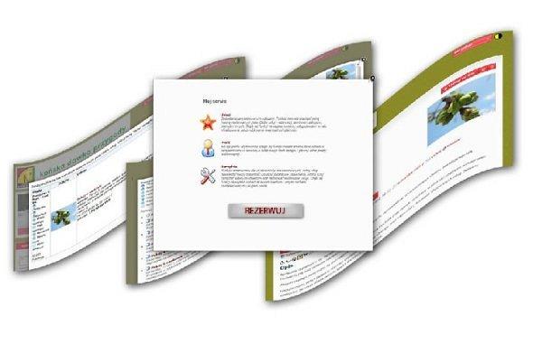
The portal of active tourism and culture and the platform of e-services
The portal, available as a system of dynamic websites, universally available on the Internet, provides comprehensive information about tourist products and the calendar of events in the region, along with the catalogue of functions allowing for presenting tourist and cultural products of the region. The websites can be also comfortably read by visually impaired people and are available in several languages.

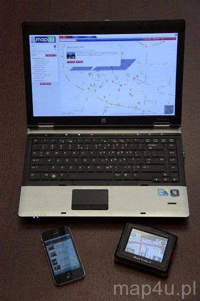
At present, digital systems of providing data are very popular and active tourists seldom use only traditional sources of information (printed maps or guidebooks). E-information systems have the advantage of an option of systematic actualization of the data and introduction of the system of mobile e-services. In a tourist-friendly region, all sections of trails, attractions and tourist facilities should be reproduced in e-space supported by mobile Internet information portal. Continual access to information should be provided using all popular Internet browsers on computers (laptops) and universally used mobile phones, as well as increasingly more popular smartphones and PDA devices.
Carefully prepared and systematically updated digital maps and information content of the portal will create favourable conditions for the idea of family tourism focused on the regional cultural heritage, as well as sports and recreation facilities. The areas of unique natural value can present themselves in interesting photogalleries. Reliable information presented on the interactive digital map allows the active tourists for planning a return to Polish roots and tradition, challenges and adventures, sitting at home in front of a computer. When the same tourists will find themselves in the field, on a trail, the database will become the basis of the GPS navigation system used by them.
The most popular e-services in the fields of tourism and culture:
- interactive publishing of content,
- booking and selling seats and tickets,
- accreditations for journalists,
- reports from the system databases.
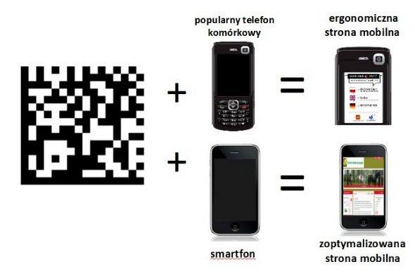
GPS navigation applications for mobile devices, QR codes and augmented reality
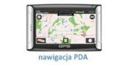
Mobile GPS devices
Mobile devices with the GPS function become a tourist guide in the field. As the quality of the video and sound transmission is high, mobile devices can as well be used as guides at exhibitions or in museum halls.
The function of multimedia guides can be supported by:
- popular mobile phones,
- smartphones,
- PDA devices.
The special package of multimedia files will extend the option of navigation by adding the function of the audioguide. So, let the device, or rather the navigation application, lead you along a sightseeing trail and the narrator will introduce you to the history of interesting objects in a chosen language. The application can be also useful while visiting museum and admiring items at various exhibitions. In addition, it can be a perfect assistant of a tourist during open-air events.
|
|
|
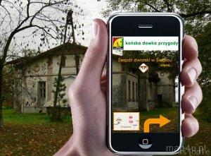
Mobile phone can be used not only for talking, since it is a mobile platform to present virtually all content published on the portal.
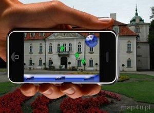
Augmented reality
The application supporting the so-called augmented reality reveals the past and the future of the surrounding reality!
The application supporting augmented reality in smartphones is:
- a comprehensive guide to a city,
- immediate geolocation on the background of nearby tourist attractions,
- a personal audioguide telling about the object, on which we focus our phone,
- faultless showing the way to a chosen destination, another object,
- easy access to services (accommodation, catering services).
QR codes
A QR code is a link to any multimedia content – a text, a picture, sound or a website. QR codes are intended for tourists having mobile phones without GPS modules. A popular mobile phone with installed application for reading QR codes acquires another interesting function. Having scanned a QR code located near an object, the phone will automatically get the access to a mobile website with information concerning the object and an option of listening to an audioguide and downloading multimedia.
The issues concerning the so-called augmented reality, QR codes and other applications for mobile devices have been discussed in details on separate information websites of the portal. On those websites, there is also an option of downloading the applications and the coordinates of objects for the car GPS navigation.
Applications for editors and administrators of the regional database, digital maps, the calendar of events and e-services
The Data Center provides updates of the content of the database and digital maps, as well as an option of e-services 24 hours a day, 7 days a week.
The Data Center applications should provide:
- continual work of an integrated network of tourist information centres which have direct contact with the customers,
- mobile update of the content of the database and digital maps thanks to the work of the staff in different locations in the region,
- supporting the organizational sections of local authorities in the promotion and organization of tourism and culture,
- integration with other projects in the fields of tourism and culture.

System functions available for editors and administrators of Data Centres allow for:
- editing the content published on the Internet portal, including the mobile portal,
- editing the interactive websites, creating QR codes for digital mapping in the field,
- easy adding of objects on the digital map (so-called “drag&drop”),
- adding elements of augmented reality,
- creating tourist trails using the objects on the map.
Attention should be brought to the fact that, for the consumers of e-information and the customers of e-services, continual work of editors and devices of the Data Centre will not be visible. In fact, tourists and providers of services will use the Internet portal. Moreover, tourists who are fans of the GPS navigation and who value the safety on the trail, will especially appreciate the information, navigation and monitoring products available for mobile devices. Today, there is no doubt that GPS services have become the only existing standard in the navigation systems.

Central mobile system of monitoring tourists on the move
A valuable and useful part of the system is the package of applications creating the central mobile system of monitoring tourists on the move.
The always active system of monitoring tourists on the move can function along the trails in the whole voivodeship. The system of targeting lost tourists, horses, bikes or kayaks will provide safety for active tourism in the region 24 hours a day, 7 days a week. The applications will help to localize and show on interactive maps the location of, for example, a lost tourist waiting for medical help. The system is supported by popular mobile phones.

What makes the proposed Information and Navigation System so innovative?
It can be recommended in many ways:
The most important feature distinguishing the system is its innovative character, which consists of following elements:
- functionality – the tourists can choose those elements, which they consider the most useful at the moment;
- many channels of communication – different ways of transferring data to tourists: laptops, mobile phone, car navigation systems, PDA devices;
- multimedia content – texts, maps, audio(guide), video, Internet;
- modernity – used technologies: QR codes, augmented reality, mobile applications;
- simplicity – both in the use and the management;
- accessibility – services not only for the owners of modern mobile phones (smartphones).
Different users will appreciate those advantages, which answer their needs.
The introduction and the management of the system should provide results such as comprehensiveness, versatility and innovative character of e-information and e-services in the context of:
- the requirements of different forms of active tourism: cycling, hiking, horseback, water and car,
- the promotion of the region and its tourist and cultural products,
- many different sources of inspiration for tourists: visiting historical places, admiring landscape and natural values, cultural and sports events,
- the preparation of the region as an area friendly and attractive for fans of active tourisms and lovers of culture, as well as for football fans.
One more advice for active tourists:
To be able to fully appreciate the charm and the services of a tourist-friendly region, you should visit the “map4U” portal and install a chosen application on your mobile device: cellphone, smartphone or PDA.
Mobile guides and augmented reality are also your future!
Host of a tourist-friendly region, treat EURO 2012 as the catalyst
1,5 million football fans, who will visit Polish stadiums during EURO 2012, are most certainly potential users of the innovative information system. However, the championship is only one month of a tourist season. Poland or your region can expect also many other interesting and popular events.

is a product for fans of culture and active tourism,
which can also be used after the championship,
in the whole future.
|
|
|
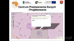
| Information and Navigation System |
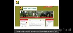
How to get access to the function of
creating an individual user’s profile on the Horseback Active Tourism Portal |
|
|
|
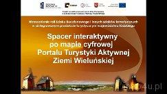
| Creating an interactive view |
Interactive walk with a digital map of
the Active Tourism Portal of the Region of Wieluń |